
[Export Utility] World to Beyond
Please note FPP is not designed for BAR - it's a complete coincidence this pipeline works!
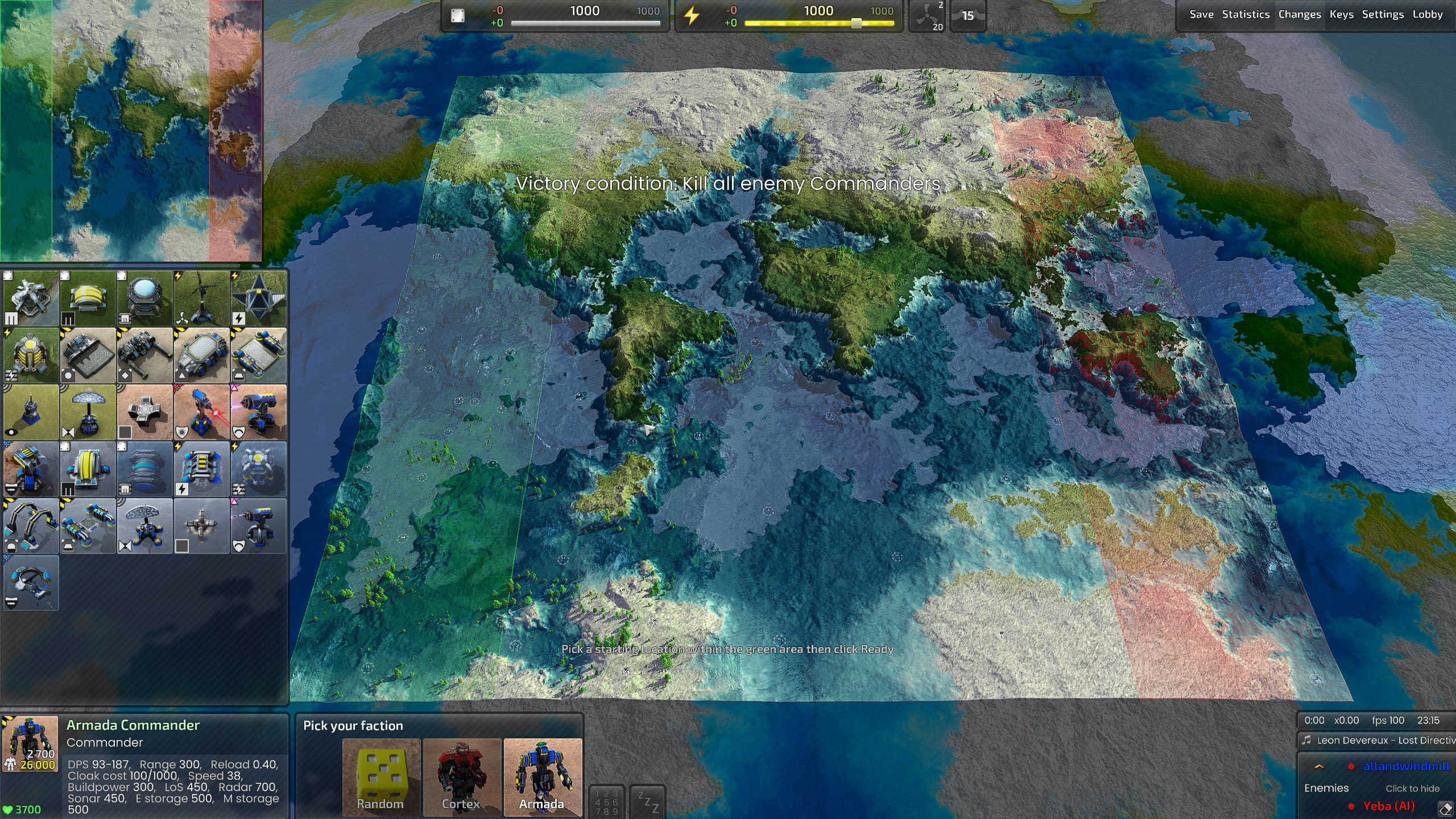
World to Beyond is a free standalone utility that builds playable Beyond All Reason maps — either from a Fantasy Planet Painter world, or from custom or procedural maps.
It compiles the complete map. There is no external dependency whatsoever (e.g. no map template, no pymapconv, and nothing borrowed
from an existing map). The .sd7 it writes contains only what you made, so it is yours to publish. This is drastically different from other available tools online for editing BAR maps.
Installation
To keep the base download small, W2B ships separately.
- Install the standard FPP distribution — Steam if you want updates automatically.
- Add World to Beyond:
- Steam: enable the Fantasy Planet Painter — World to Beyond DLC.
- Itch.io and elsewhere: patch your installation with the Resources archive.
That is the whole list. The information on this page may be ahead of or behind what's actually available. Earlier versions needed you to supply a GeneratorTemplate.zip taken from a map that shipped with the game, which was awkward to obtain and made the result legally murky to redistribute. That step is a past — the latest tool writes the .smf, the .smt and the mapinfo.lua from scratch.
Launch
- Steam: use the launch option World to Beyond.
- From inside FPP: File → Advanced Exports → BAR Spring Map.
You can also open it with a planet file directly, and it will start on that world.
The Seven Stages
The tabs at the left is the stages of the entire process. It is a list of what a map is made of, and you can work down it in order or jump about as you like. A tick means that stage has given the map something.
| Stage | What it decides |
|---|---|
| Source | Where the terrain comes from, and how big the map is |
| Terrain | The landform — style, relief, sea level, symmetry, player count |
| Metal | Where the extractor spots are |
| Grass | Where vegetation grows |
| Water | The sea's colour and behaviour, as the engine will render it |
| Features | Rocks, trees and imported models, and where they are scattered |
| Output | The map's name, where it is written, and the build itself |
Source
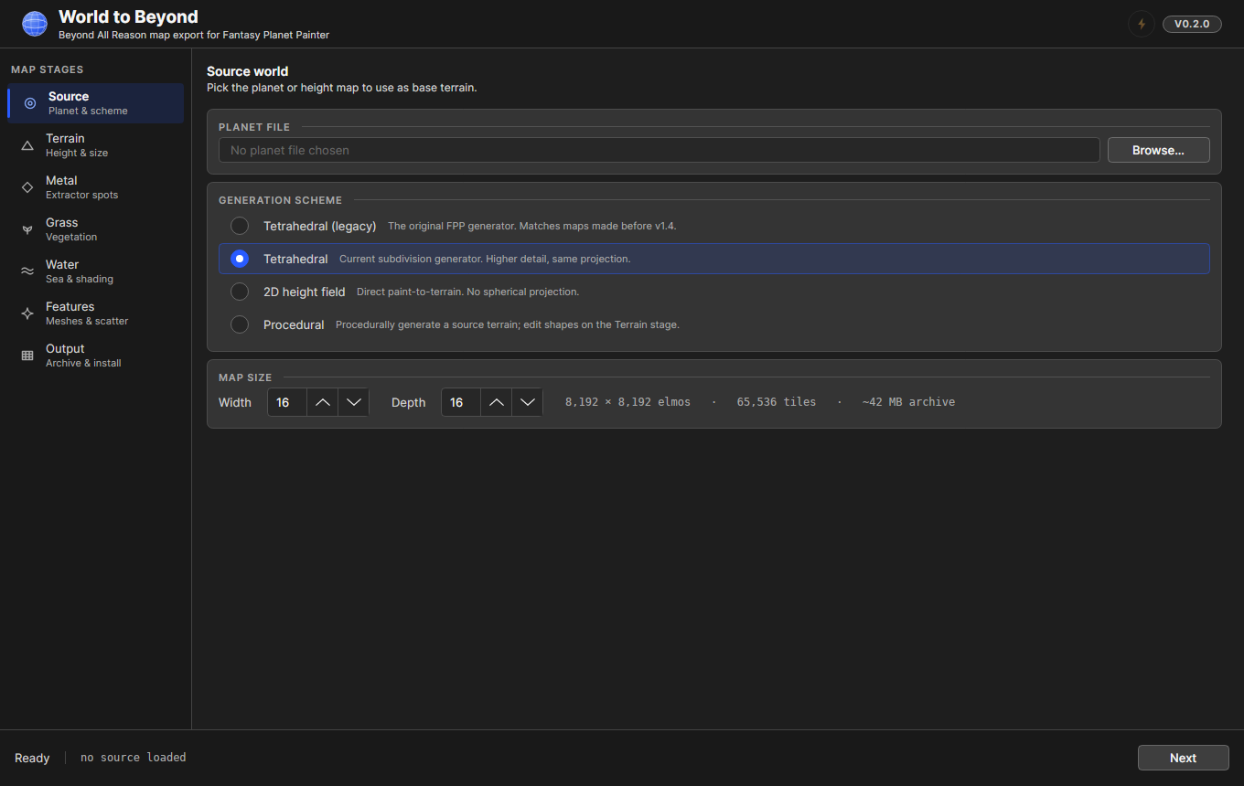
Pick a .planet file and a generation scheme:
- Tetrahedral (legacy) — the original FPP generator. Matches maps made before v1.4.
- Tetrahedral — the current subdivision generator. Higher detail, same projection. (These two render identically today — see Limitations.)
- 2D height field — direct paint-to-terrain, no spherical projection. For FPP's flat worlds.
- Procedural — no source world at all. The tool invents the terrain, and you shape it on the Terrain stage.
Map size is in Spring map units, where one unit is 512 elmos. 2 to 64 is the practical range; BAR's own maps are usually 8×8 to 32×32. The readout tells you the size in elmos and roughly how large the finished archive will be, which is worth glancing at before you ask for a 48×48.
Terrain
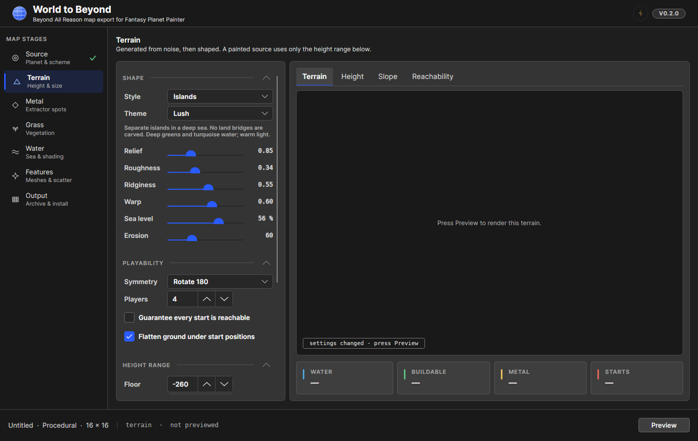
For a planet source this stage only sets the height range. For a Procedural source it is the whole generator.
Style is the first control, and it moves the others. Picking one fills in the sea level, relief, roughness, warp, erosion, height range, the connectivity setting and the theme — because a style is a claim about what kind of map this is, and the claim is false without the settings that go with it. Islands at a continent's sea level is just a scattering of hills.
| Style | What it makes |
|---|---|
| Continental | One land mass with a mountain spine, a landable coast and inland seas |
| Islands | Separate islands in a deep sea. No land bridges are carved |
| Highlands | High ground in four distinct tiers, cut by a network of ravines |
| Plains | Open buildable ground: shallow swells, dune fields and standing water |
| Canyons | A tableland cut by connected gorges, with a river along the floor |
| Mesa | Flat-topped buttes on a dry desert floor. No sea |
| Volcanic | Cones with craters at their summits, standing in basins of lava |
Theme sits beside it and decides the ground colours, the vegetation, the lighting and the water. Each style starts on the theme it was written for, but the two are separable — an ice sheet and a steppe are the same landform — so you can pair any theme with any style.
| Theme | Look |
|---|---|
| Temperate | Green and grey; ordinary daylight |
| Desert | Sand and red rock; hard, high sun |
| Arctic | Snow, ice and blue shadow; low pale light |
| Alien | Violet rock and cyan growth; strange light |
| Volcanic | Black basalt and ash; lit from the lava |
| Lush | Deep greens and turquoise water; warm light |
Playability is the part that decides whether the map is worth playing: symmetry, how many players, whether every start is guaranteed to reach every other, and whether the ground under each start is flattened into a build pad.
Press Preview to render. The four tabs beside it — Terrain, Height, Slope, Reachability — are different questions about the same landform, and the readouts underneath tell you how much of the map is water, how much is buildable, how much metal there is and where the starts landed.
You can also import a height map or a ground texture made elsewhere. Height maps are read at 16 bits from a PNG, which is the only depth that does not visibly terrace a planet's relief.
Metal
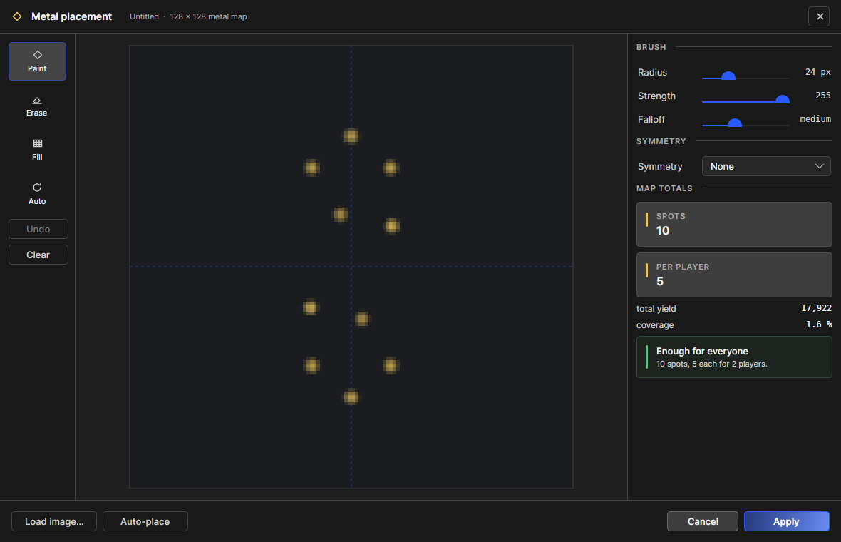
Extractor spots decide whether a map is playable at all, so this one opens its own window with the canvas at full size.
Auto-place does the sensible thing — spots per player, spread with symmetry, kept off cliffs. From there you can paint, erase, fill, load a metal map as an image, and undo. The readout tells you how many spots there are, how many that is per player, and warns you when somebody would start with none.
Nothing reaches the map until you press Apply, so backing out is free.
Grass
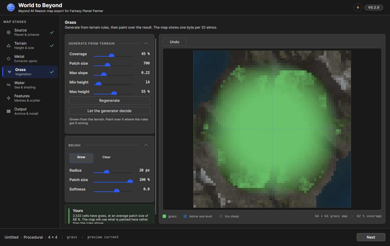
Grass is generated from the terrain first, then painted over. The rules — coverage, patch size, slope limit, height band — grow it where the ground suits it, and the brush is for the places the rules got wrong.
Note that grass is a graded patch size, not on or off: every cell stores a value that decides how tall that clump grows. BAR reads it that way through its own grass widget.
The mouse wheel over the canvas resizes the brush, which is true of all three painting surfaces here.
Water
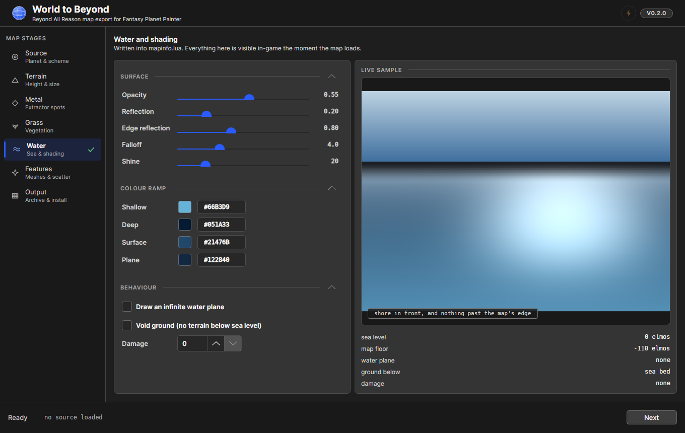
Everything here is written into mapinfo.lua and is visible in-game the moment the map loads. The controls are named for the engine keys they set, and the live sample is shaded with the engine's own water shader, seen from a playing angle — four of the five surface controls are functions of the angle water is viewed from, so a top-down sample would show you nothing.
Worth knowing: edge reflection is added to reflection, not the value it rises to. Seen edge-on, a surface reflects the two together.
Features
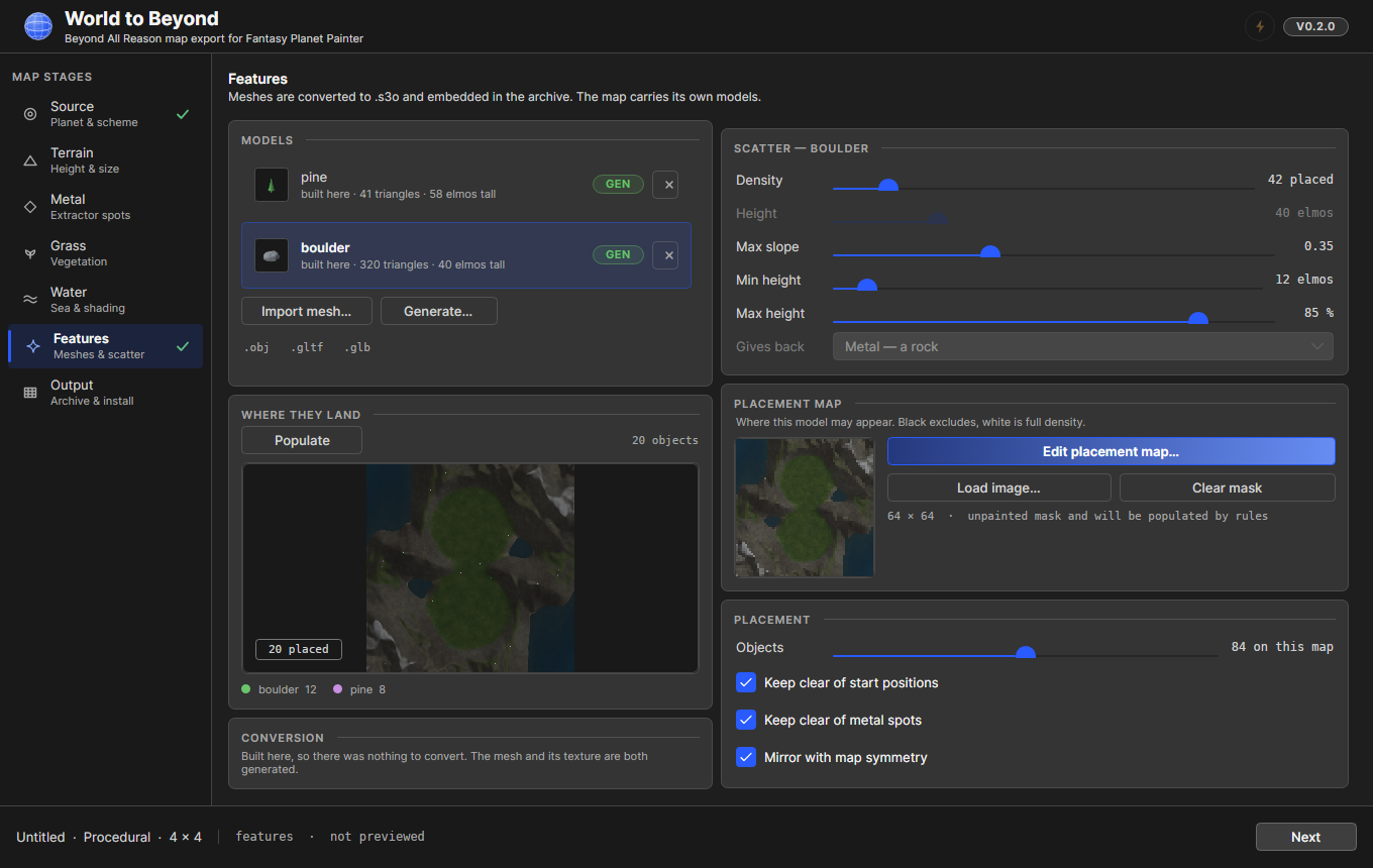
Rocks, trees and anything else standing on the map.
- Import mesh takes
.obj,.gltfand.glband converts them to.s3o, with a conversion report telling you what it did. - Generate builds rocks and trees procedurally — these are marked GEN in the list.
- Either way the model is embedded in the archive, so the map carries its own scenery and needs nothing installed alongside it.
Each model has its own scatter rules (density, slope limit, height band, what it drops when killed) and its own placement map — a paintable mask saying where that model may appear. One shared mask could only say "scenery here, none there"; a mask per model lets you put pines on the ridge and boulders on the shore.
Populate runs the real placer over the real terrain and draws where everything lands. It takes a fraction of a second, so you can answer "is that too many trees" by looking instead of by building the map.
Output
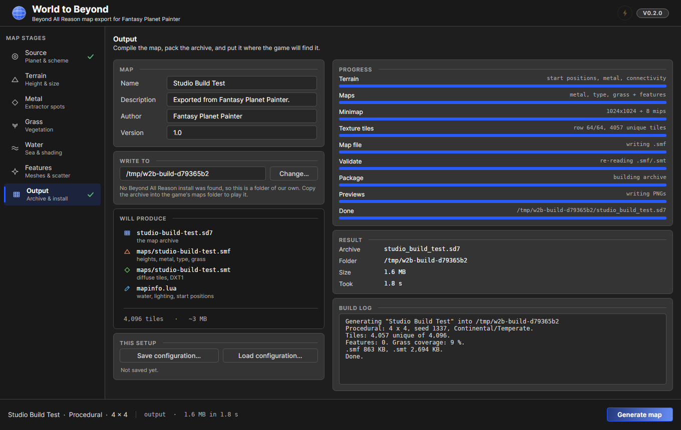
The map's name, description, author and version; where the archive is written; and what that will produce, listed before you commit to it.
The destination defaults to the game's own maps folder when W2B can find a BAR installation, so a finished map is playable without hunting for it. If no install is found it says so and uses a folder of its own.
Generate map builds the real thing, with live progress per stage and a build log. Pressing it again cancels — and cancelling genuinely stops the build rather than just changing the label.
Save configuration writes a .w2b file: every setting and every painted channel, so a map is not something you have to finish in one sitting. Models are referenced rather than copied, so editing one and reopening the project picks up the change.
Previewing in 3D
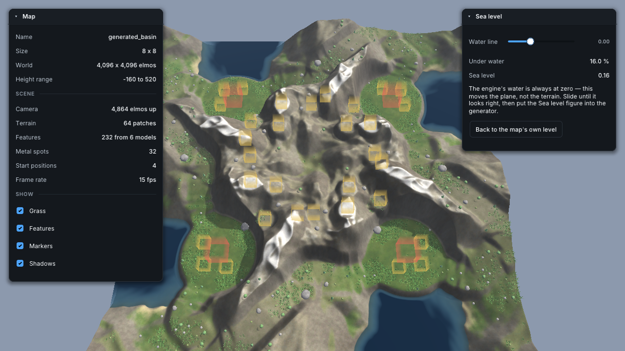
The lightning bolt beside the version number opens the map in a real-time viewer, fullscreen, using the same overhead camera Beyond All Reason opens on — ground, water, grass, scenery and shadows, as the game would draw them.
It is greyed out until something has rendered the terrain; render a preview on the Terrain stage and it lights up. Nothing is generated and no archive is written, so it opens in about the time it takes to upload a height field.
| Control | Does |
|---|---|
Mouse at screen edge, or W A S D |
Pan |
| Wheel | Zoom towards the cursor |
Ctrl + wheel |
Tilt |
| Drag with either button | Move the map around |
Shift |
Faster |
F |
Frame the whole map |
Tab |
Hide the panels |
Esc |
Close |
A translucent box marks every extractor spot and start position, which is the quickest way to see whether the metal is spread the way you meant.
The Sea level panel moves the water plane and reports what fraction of the map ends up under it. That figure is the Terrain stage's Sea level slider: drag until the coastline looks right, read the number, and put it in. It does not change the map — the engine's water is always at zero — so nothing comes back from the viewer and nothing needs to.
The viewer needs OpenGL 4.3. On a machine whose driver does not offer it, the Studio says so in the status bar and carries on.
Tutorial
A quick start
From an FPP world:
- Make your world as usual and save the
.planetfile. - Open W2B, Source → browse to the planet, pick the scheme that matches how you made it.
- Terrain → set the height range and press Preview.
- Metal → Auto-place, then Apply.
- Output → give the map a name and press Generate map.
Without one:
- Source → Procedural, and choose a size.
- Terrain → pick a Style, set the player count and symmetry, press Preview. Try a few seeds until you like one.
- Walk the rest of the rail, or skip straight to Output. Anything you do not touch, the generator decides.
Along the way, the bolt beside the version opens whatever you have so far in 3D.
Limitations
FPP is a map painter, not a level editor. A world that reads beautifully as a fantasy map is not automatically a good RTS map, and nothing here changes that. Expect to spend time on the Terrain and Metal stages making the result playable rather than merely handsome.
A planet is projected with Mercator, and only Mercator. Unrolling a sphere onto a square stretches ground near the poles, so a world's polar regions arrive distorted. Frame the part of the planet you care about near its equator, or use the 2D height field scheme, which paints straight to terrain with no projection at all.
The two tetrahedral schemes currently render the same terrain. They differ in how FPP subdivides the sphere, and the renderer does not yet expose that choice — so the setting is recorded on the project but does not change the output. Picking one over the other today makes no difference.
A projected planet is not symmetric. A generated map's terrain is, so its metal and grass are folded to match; a planet's is not, and folding rules derived from it would put grass on ground that does not grow it. Brushes are exempt — painting metal symmetrically on an asymmetric world is a choice you are entitled to make.
Big maps cost real time and memory. The texture is eight texels to a square, so a 32×32 map is 16,384 texels across before compression. The Source stage shows the estimated archive size; take it seriously.
The map is terrain, not a scenario. W2B writes ground, water, metal, grass, scenery, start positions and mapinfo.lua. It does not author unit placement, wreckage, custom Lua gadgets or gameplay scripting.
The 3D preview needs OpenGL 4.3. The Studio itself does not — only the viewer.
Troubleshooting
The build log ends in an error. It names the stage that failed. The most common cause is a map size the machine cannot hold — a 32×32 map is a 16,384-texel texture before compression.
No BAR installation was found. W2B writes to a folder of its own and says where. Copy the .sd7 into your BAR maps folder to play it.
The 3D preview button is greyed out. Nothing has rendered the terrain yet. Go to Terrain and press Preview; the tooltip says so too.
The 3D preview will not open. It needs OpenGL 4.3. The status bar reports what the driver offered.
Resources
- Resources archive — patches an FPP installation with World to Beyond. Not needed if you have the Steam DLC.
- BAR Map Technical Specification — the
.smfand.smtformats,mapinfo.lua, and the conventions behind them, byte by byte. For anyone curious about what a map actually is, or building their own tooling. It describes the format only; it says nothing about this tool.
Making the Map Yours to Publish
Everything in the archive is generated by the tool or supplied by you — terrain, textures, metal, grass, water settings, models. Nothing is copied out of an existing map. That was not true of earlier versions, which unpacked a template taken from a shipped BAR map; if you have maps built that way and mean to distribute them, rebuild them with the current tool.